Listen here on Spotify | Listen here on Apple Podcast
Episode released on May 21, 2026
Episode recorded on March 12, 2026
 Wolfgang Kinzelbach talks about strategies for groundwater recovery from overexploitation in the North China Plain.
Wolfgang Kinzelbach is Professor Emeritus of Hydromechanics at the Swiss Federal Institute of Technology (ETH) in Zurich (Switzerland). His research focused on many aspects of hydrogeology, including modeling and monitoring of water quantity and quality. This podcast focuses on his work in China, including the North China Plain and the Tarim Basin.
Highlights | Transcript
- Wolfgang published a book with co-authors in 2021 titled “Groundwater Overexploitation in the North China Plain: A Path to Sustainability” (Fig. 1).
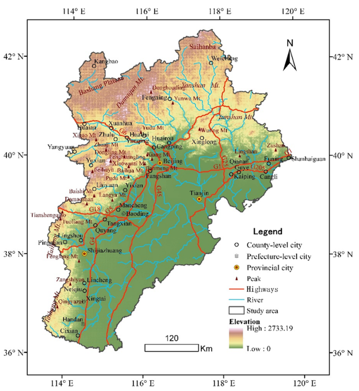
- The North China Plain is surrounded by mountains in the north (Yan Mtns.) and west (Taihang Mtns.), Yellow River to the south, and Bohai Sea to the east (Fig. 2).
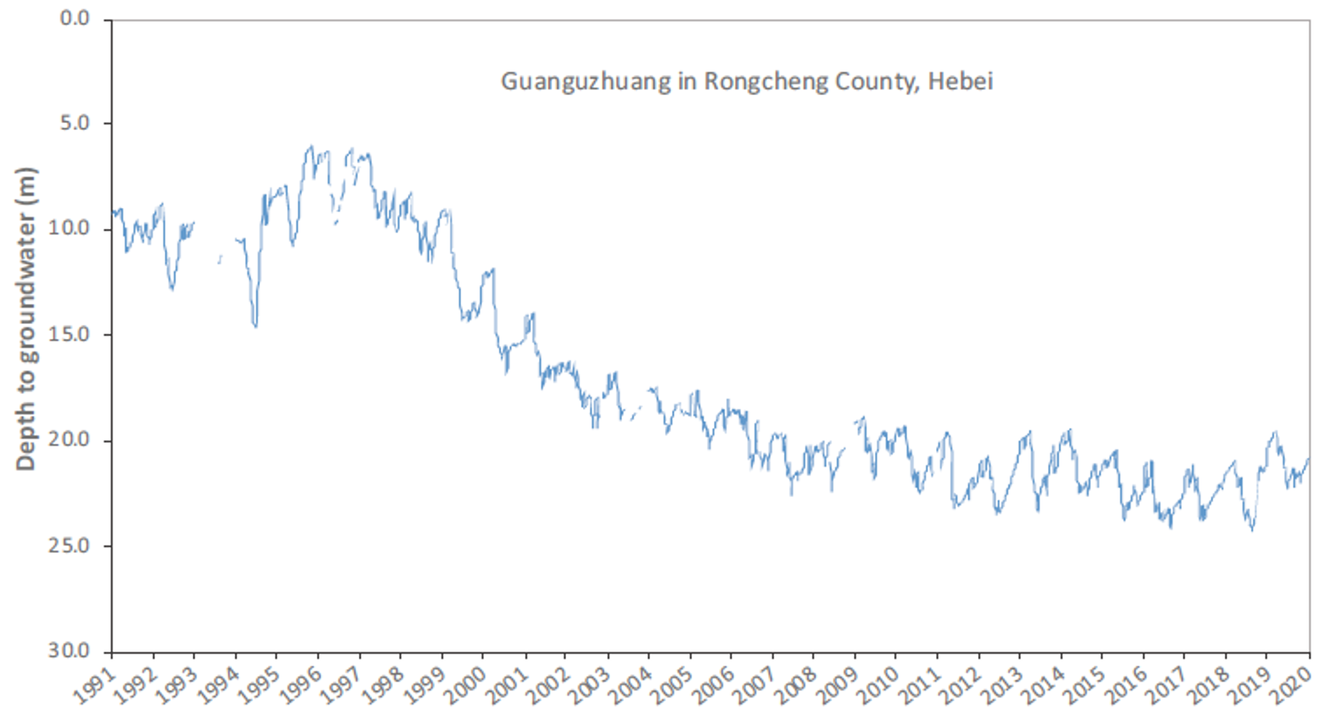
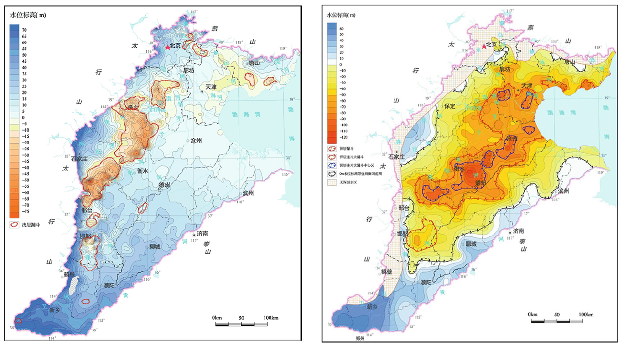
- The North China Plain is a global hotspot of groundwater depletion. Groundwater depletion reached extreme levels—declines of up to ~1 m/year in some areas since the 1980s (Fig. 3) and ~4–8 km³/year declines depending on the period in some regions (Fig. 4). Declines are also evident in land subsidence.
- Shift from surface water to groundwater irrigation: historically, irrigation relied on surface water, which caused waterlogging and salinization. Electrification (≥1950s) enabled widespread groundwater pumping, solving waterlogging but leading to overexploitation. This illustrates a classic “overcorrection” in water management.
- Cropping patterns drive depletion: double cropping—winter wheat and summer maize—is central. Winter wheat (grown in the dry season) requires 3–4 irrigations, making it the primary driver of groundwater depletion, whereas summer maize largely depends on rainfall.
- Aquifers act as long-term storage (“savings accounts”) compared to surface reservoirs (“checking accounts”). Maintaining groundwater reserves is essential for resilience to drought and climate variability.
- Complexity of aquifer systems (shallow vs. deep): the NCP contains shallow (phreatic) and deep confined aquifers. The shallow aquifer supplies irrigation water but is saline (>1 g/l TDS), while the deeper aquifer is fresh and provides drinking water. Despite lower pumping, the deep aquifer shows greater drawdown due to lower storage capacity.
- Socioeconomic constraints: smallholder farming: Farms are extremely small (≤~0.3 ha, ~1 acre), limiting profitability. Younger generations leave agriculture, leading to aging farmers and structural shifts toward larger, consolidated farms.
- Transition toward modern, technology-driven agriculture: future farming is moving toward larger, mechanized, and data-driven systems (e.g., drones, sensors, precision irrigation). Farmers will increasingly resemble engineers, optimizing inputs and efficiency. This process will probably make farming more attractive for young people.
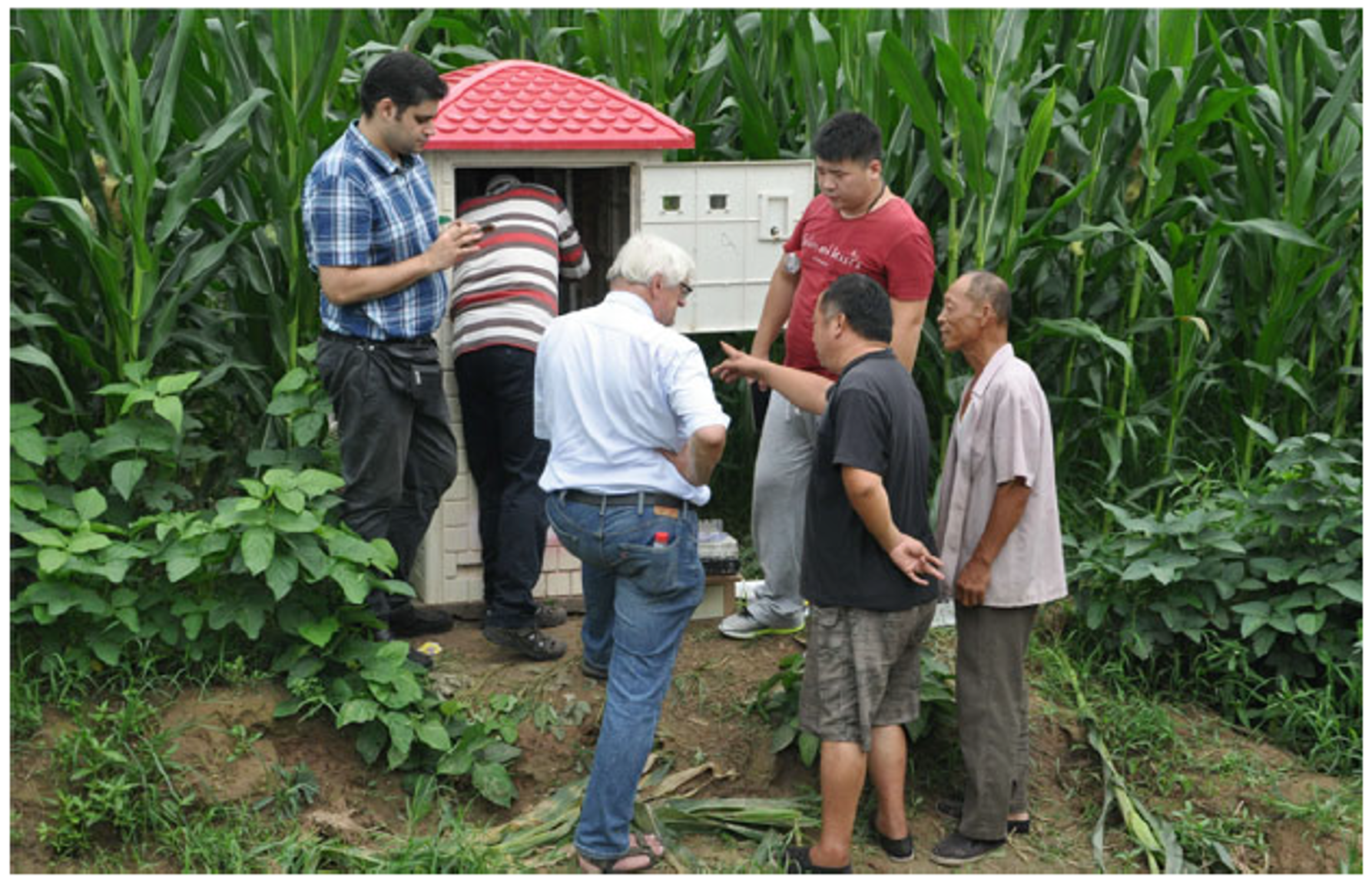
- Monitoring groundwater use: innovation and challenges. Direct smart metering failed due to maintenance and cost issues. A key innovation was using electricity consumption as a proxy for pumping, calibrated with field tests. This enabled large-scale estimation of groundwater withdrawals that was originally deployed in Guantao and later expanded to the whole of Hebei province.
- Policy experiments and incentives for water savings: China implemented pilot policies, including:
- Subsidies to stop growing winter wheat
- Payments upfront to cover water fees with savings retained by farmers
- Satellite monitoring to verify compliance
“Societal experiments” tested what works before scaling policies.
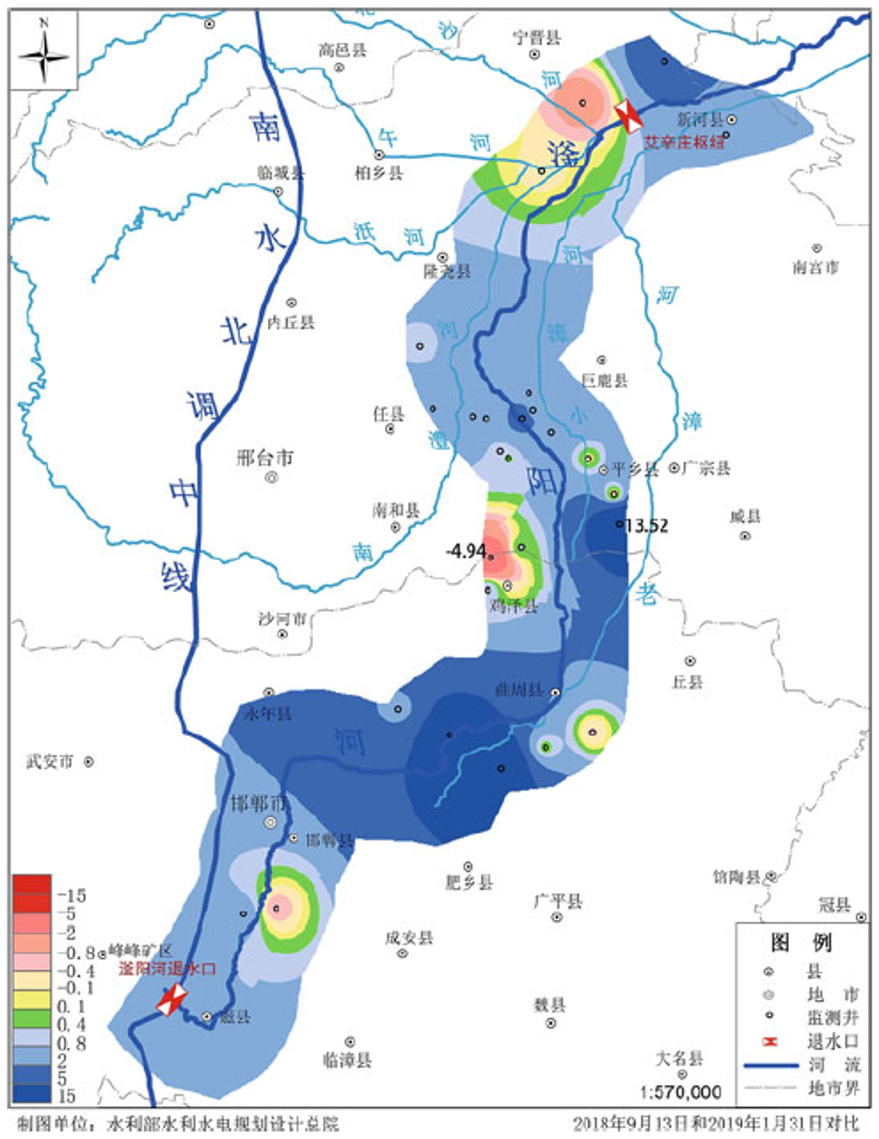
- Multiple drivers of groundwater recovery: recent groundwater recovery in shallow aquifers and slowing or zero decline of heads in deep aquifers is attributed to:
- South–North Water Transfer (reducing groundwater use for households and industries)
- Agricultural policy changes and reduced irrigation
- Favorable rainfall
Each contributed roughly one-third to improvements.
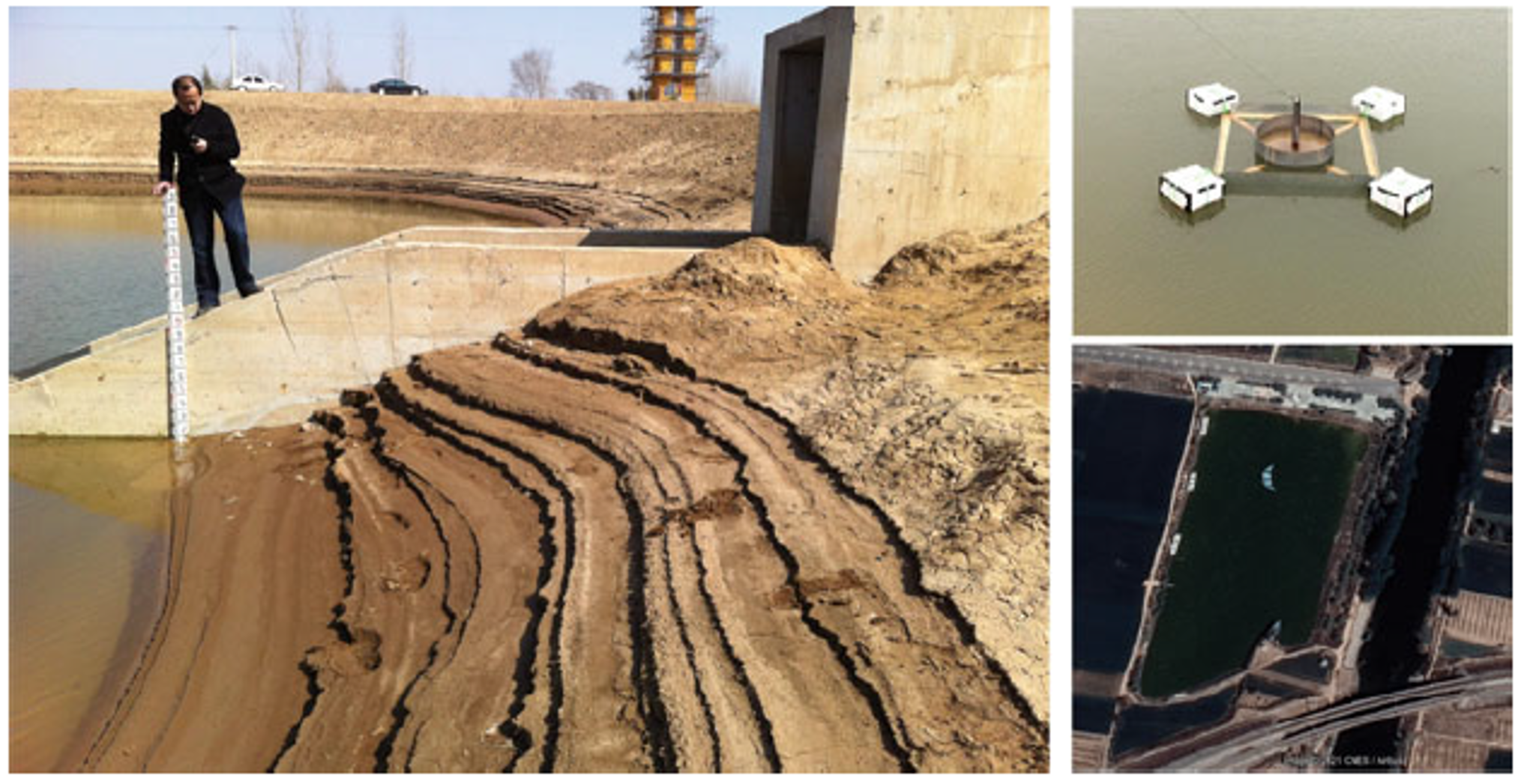
- Managed aquifer recharge and infrastructure tradeoffs. Recharge strategies include infiltration basins (Fig. 6) and diverting water into riverbeds (Fig. 7). Infiltration basins enhance groundwater replenishment but reduce cultivated land, creating tradeoffs between water sustainability and food production.
- Emerging water quality risks: rising water tables create hydraulic gradients that may push saline water from the shallow aquifer into the deeper drinking-water aquifers. This highlights a shift from quantity problems to future water quality challenges.
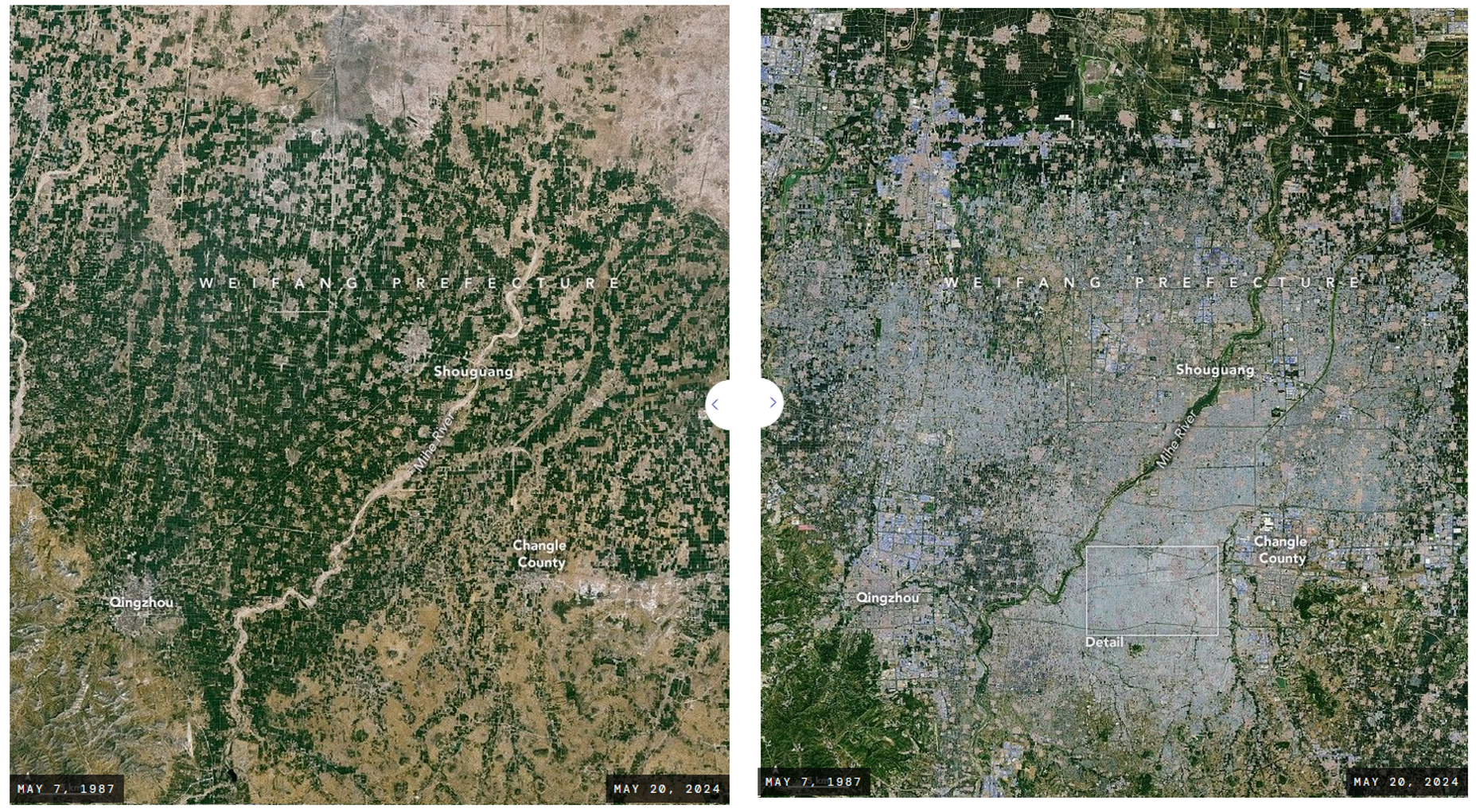
- Greenhouses: China accounts for ~60% of global greenhouses (Fig. 8, Tong et al., Nature Food, 2024) which allow intensification of water use: Although greenhouses reduce evaporation, they enable multiple cropping cycles (beyond double cropping). They usually employ drip irrigation systems. While increasing “crop-per-drop” considerably they also increase total water demand per acre. They are a surprising new contributor to year-round groundwater use.
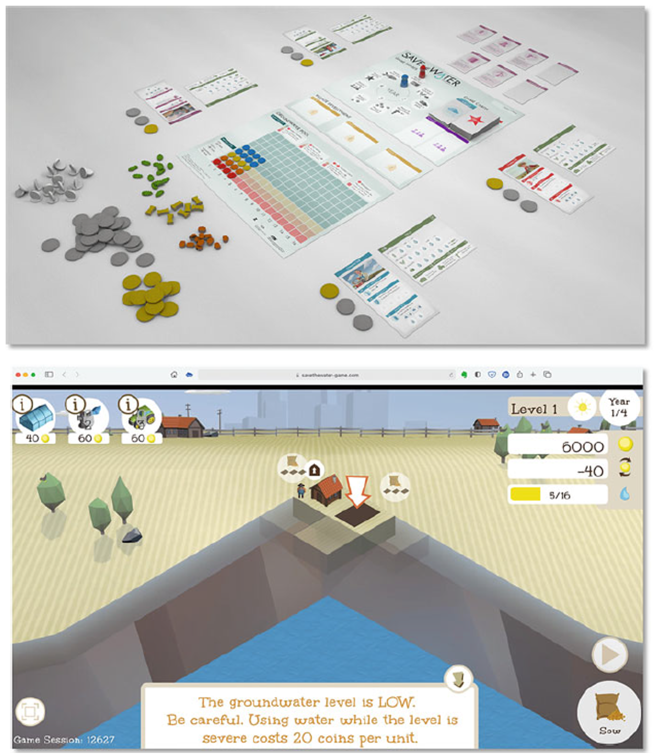
- Save the Water (StW) board game was designed to work with farmers and assess different options for managing water resources in the North China Plain (Fig. 9).
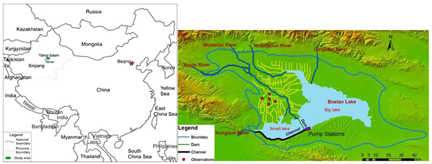
- Yanqi Basin, NW China (Fig. 10): represents contrasting but related challenges. Irrigation caused water table rise, phreatic evaporation, and salinization. Groundwater use solved the salinization problem but led to overexploitation. Expansion of irrigated land (rather than intensification) is the key sustainability challenge in this region. Farm size is much larger than in the North China Plain and many farms are state owned. There is a lot of room for expansion of irrigation, unlike in the North China Plain. The hotspot of groundwater overexploitation in China has shifted from the North China Plain to China’s West.
- Key insight: no “one-size-fits-all” solution: Effective groundwater management requires a portfolio of approaches—policy, infrastructure, incentives, and monitoring. The system must be adaptive and region-specific rather than relying on a single solution.
- The case of the North China Plain shows that large-scale groundwater depletion can be reversed, but only through integrated approaches combining policy, technology, monitoring, and stakeholder engagement—with new challenges (especially water quality) emerging as systems recover. It is not easily replicated in governance systems different from the Chinese one.
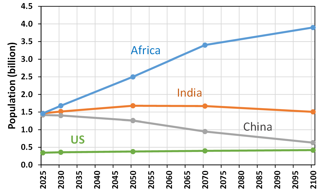
- Water quantity issues in the North China Plain are not expected in the future with projected population decline from 1.4 billion (2025) to 0.6 billion (2100) (UN Medium projection) (Fig. 11).